Hatteras Island Braces for Hurricane Aaron’s Impact
Mandatory Evacuations Issued as Hurricane Aaron Strengthens
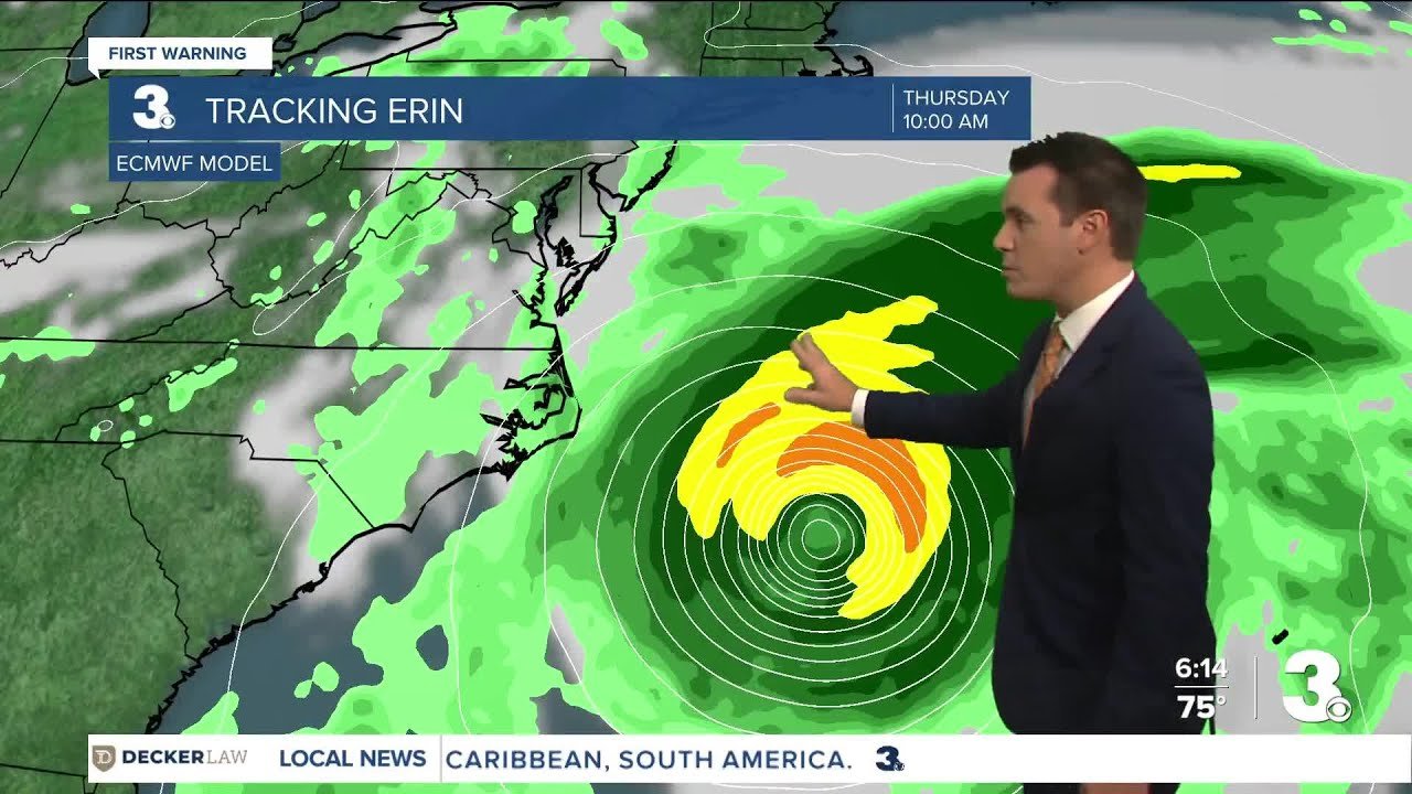
Hatteras Island and surrounding coastal areas are under a state of emergency as Hurricane Aaron, now a Category 4 storm, threatens dangerous conditions along the North Carolina coast. Mandatory evacuations have been ordered for Ocracoke Island in Hyde County and parts of Dare County, including Hatteras Island, as officials warn of life-threatening rip currents, high waves, and beach erosion.
The evacuations begin at 10 a.m. on Tuesday for visitors and 8 a.m. for residents, with emergency teams urging people to leave before conditions worsen. While the storm is expected to stay offshore, its effects will still be felt along the Outer Banks, particularly in vulnerable areas like Hatteras Island, where Highway 12 is at risk of flooding and erosion.
Hurricane Aaron’s Latest Track and Threats
A mandatory evacuation order has been issued for Hatteras Island, which is designated as Zone A. Zone A includes all of Hatteras Island, including the unincorporated villages of Rodanthe, Waves, Salvo, Avon, Buxton, Frisco and Hatteras. https://t.co/ct5neLytGN pic.twitter.com/sVAGvFzBvW
— WTKR News 3 (@WTKR3) August 17, 2025
Meteorologists confirm that Hurricane Aaron has intensified, with sustained winds reaching 130 mph. The storm is currently moving northwest at 10-15 mph, passing northeast of the Turks and Caicos Islands. Forecast models predict the hurricane will curve away from the U.S. coastline by midweek, but not before bringing hazardous conditions to the Carolinas.
Key threats to Hatteras Island and nearby regions include:
Dangerous rip currents – A major risk for swimmers and surfers.
Coastal flooding – High tide combined with storm surge could inundate low-lying areas.
Beach erosion – Waves up to 20-25 feet offshore may worsen shoreline damage.
Strong winds – Gusts could lead to power outages and property damage.
Preparations Underway for Hatteras Island Residents
Local officials are closely monitoring Hurricane Aaron’s path, emphasizing that while a direct hit is unlikely, the storm’s outer bands will still pose risks. Emergency management teams are advising residents and visitors on Hatteras Island to:
Follow evacuation orders – Leaving early ensures safety and avoids last-minute road congestion.
Secure property – Board up windows, move vehicles to higher ground, and tie down loose objects.
Stock up on essentials – Have food, water, medications, and batteries ready in case of prolonged outages.
Highway 12, the only major route on and off Hatteras Island, is particularly vulnerable to flooding. If the storm’s impacts worsen, road closures could strand residents, making early evacuation critical.
What’s Next for Hatteras Island and the Outer Banks?
Scenes from the Outer Banks this morning. Long line at the Ocracoke to Hatteras ferry. Stretches like this one on Pea Island will see the most damage from 15-20 ft waves. #ncwx pic.twitter.com/x8prf5vUVH
— Zach Holder (@ZachHolderWx) August 18, 2025
The latest forecast suggests Hurricane Aaron will weaken slightly to a Category 3 storm by Tuesday but remain a significant offshore threat. The greatest impacts are expected Wednesday into Thursday, with high surf and coastal flooding peaking during high tide.
While the storm’s core will stay away from land, the National Hurricane Center warns that even distant hurricanes can produce deadly rip currents and beach erosion. Residents and visitors in Hatteras Island, Ocracoke, and other Outer Banks communities should remain vigilant.
Conclusion: Safety First for Coastal Communities
As Hurricane Aaron churns in the Atlantic, the focus remains on protecting lives and property along the North Carolina coast. Hatteras Island, known for its scenic beauty and vulnerability to storms, is once again at the forefront of hurricane preparedness efforts.
For now, the best course of action is to heed evacuation orders, stay informed through official weather updates, and avoid risky coastal activities until the storm passes. With proper precautions, Hatteras Island and its resilient community can weather this storm safely.


